For those of us paying attention, February wasn’t that cold. Or wet. Still, El Niño hasn’t forgotten Los Angeles, at least not yet.

Many scientists have been talking about the potential dangers the current El Niño weather pattern could deliver to the west coast. Bill Patzert, NASA’s top climatologist doesn’t sugar coat the threat: “The El Niño warm pool, directly south of Southern California, is two and a half times the size of the continental United States. This is immense, and it’s had a huge, punishing impact in continents all around the planet. Suffering droughts in South Africa, floods in South America, much of Southeast Asia is in a punishing, very costly drought. There’s really isn’t any place on the planet that doesn’t have the fingerprint of El Niño on it.”
But, what about the rain?
January was a bit wetter than “normal.” February was drier – in fact, some cities such as San Diego had the warmest February on record. Combined, the two months saw rainfall the was “average” for the State. That’s better than the past four years, but it hasn’t been what people have been expecting.
Scientists say a dome of high pressure has kept the El Niño storm track well to the north, helping build vital snowpacks in the Sierra Nevada and elsewhere in West but leaving the southern half of the Golden State mostly hot and very dry.
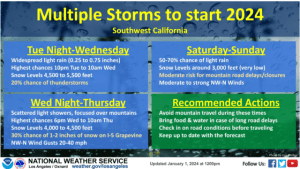
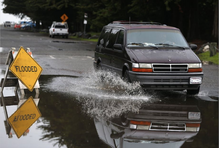
This coming weekend may see only the third real rainy episode so far in 2016. It could be a dangerous storm. One of the misconceptions about El Niño is that it means continuous rain. It doesn’t mean daily rain. It doesn’t mean weekly rain. It means that the El Niño warm pool could push dangerous storms over the coast of California. The National Weather Service believes this is the start of a potentially rainy March, but that might only mean five or six days of wet weather. The danger is that too much water falls during those days – leading to floods, mudslides, and other threats to our typically sunny Southern California existence.

According to the NWS, the first round of rain will begin to move onshore over parts of the Pacific Northwest and northern and central California by Friday evening. More rounds of rain are likely to follow Sunday and into next week.
LEARN HOW TO PREPARE FOR EL NINO.
Enough rain may fall in the coming days to improve the serious drought conditions across the state, according to AccuWeather. As of Thursday’s U.S. Drought Monitor, about 95% of California remains in a drought, the highest percentage of any U.S. state.
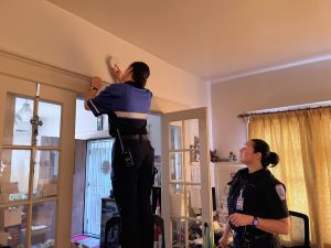
MySafe:LA and the Los Angeles Fire Department want to remind you that it’s better to be prepared for bad weather, than to be caught out and be impacted by mudslides, flooding, or other consequences of serious rainfall. Remember, every fire station in the City of Los Angeles has sandbags. A number of fire stations have sand as well. Check the LAFD website for additional information.